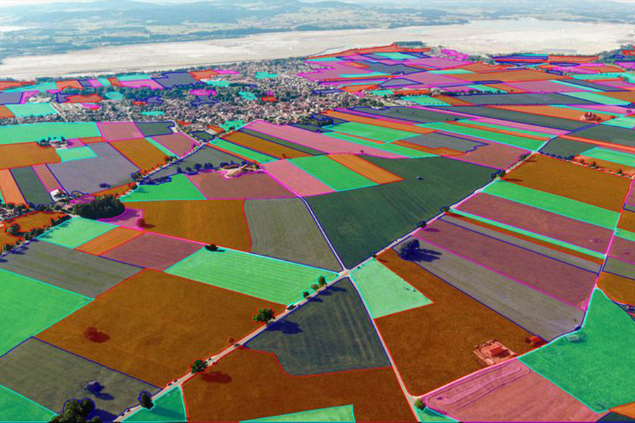
Polygon Annotation Aerial View
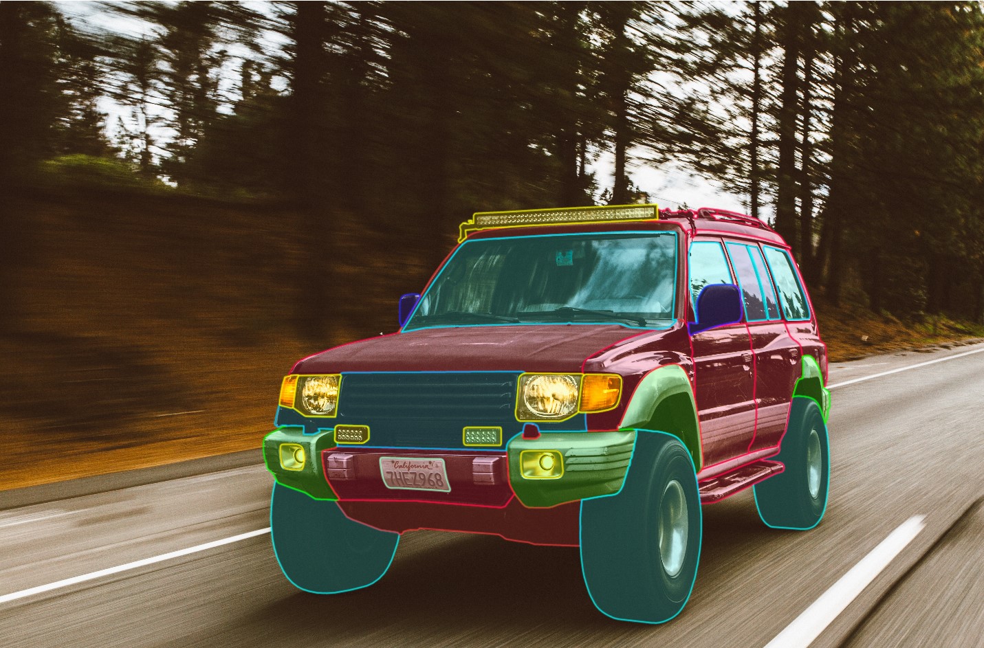
Polygon Annotation Car Parts
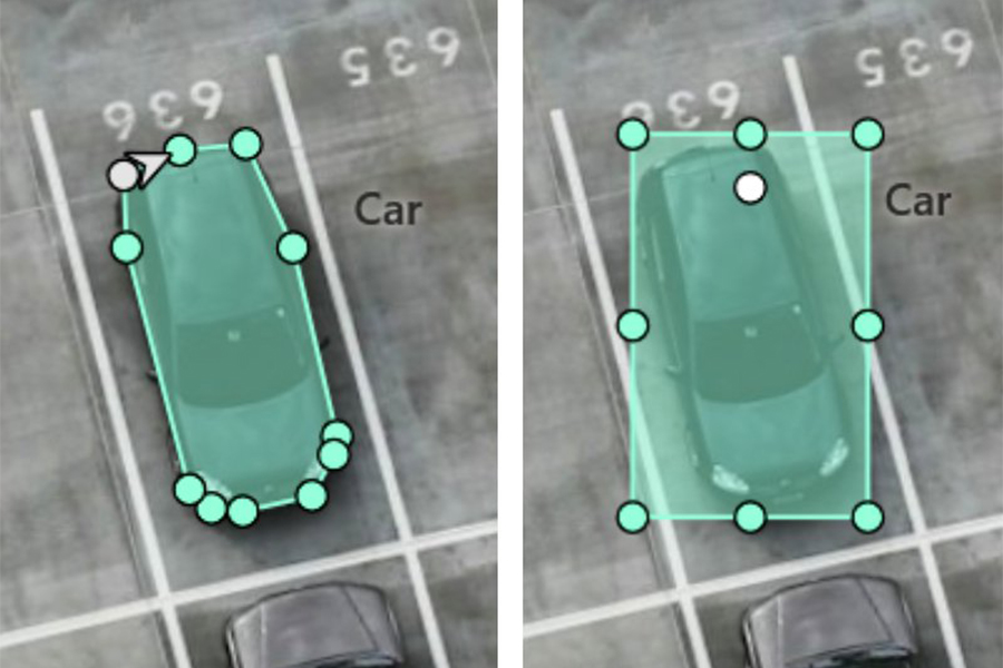
The transformation of raw visual data in the form of photographs into labeled images is known as polygon annotation. This makes it easier to provide machine learning models with training data sets. Polygon annotation can also be used to make undefined and unseen shapes recognizable. One of the most important aspects of computer vision is polygon annotation. It helps a machine to comprehend its environment. It helps self-driving cars avoid impediments including people, traffc jams, and other vehicles on the road. When working with great accuracy and precision, bounding boxes are no longer acceptable; here is when polygon annotation is useful.
Recognition of irregular images, lines, and angles are easier using polygon annotation. It also allows us to map and label the objects that are particularly visible in an image or that are in some way occupying virtual acceptance. Polygonal annotation is used in industries like autonomous vehicles drones, satellites, picture masking, and image tagging.
We are known for providing highly accurate polygon annotation and training data sets that are widely used. We provide unmatched services for detecting and recognizing automobiles, specific shapes in photos, and training data sets.
For any autonomous system to correctly identify and interpret the enormous data available in today’s time, perfect accuracy is necessary, and polygon annotation does just that. Our highly skilled annotators use the polygon annotation to perform a variety of data detection tasks. High precision and efficiency of the polygon annotation are required for excellent semantic segmentation which we gladly provide to our clients.
The phenomena of aerial object localization are extremely important for gadgets and technology such as drones and satellites. To characterize the proper object as well as the target, it is critical to execute the recognition and mapping in a highly exact manner. The polygon annotation assumes responsibility in this application. Our polygon annotation capabilities are mastered to help you get the best aerial object localization along with your devices. It enables various aerial objects to localize and detect exact objects and identify their positions.
One of the most common uses of polygon annotation is in agriculture, where our services enable the precise and accurate detection of various agricultural patterns such as tracking bug positions, crop rows, and so on. Regardless of the industry, we create a 360-degree experience for our clients.
We work with highly trained annotators (in-house employees) to provide our clients with the finest possible final results. We have a reputation for working with a high level of accuracy in our work, which demonstrates expert professionalism in results. We are known for our expertise in machine learning and data annotation. For your machine learning devices, Yagmur Tech provides high-quality, dynamically updated, and vastly diverse training data sources. We offer high-quality polygon annotation at affordable pricing. You can train your algorithms with our best-in-industry datasets and services, as well as our high-quality data sets.